
Olean is a city in eastern Cattaraugus County. It was served by the Erie Railroad, Pennsylvania Railroad, and Pittsburgh, Shawmut and Northern Railroad as well a numerous street railways and interurban lines. Olean was a center for the lumber industry, and later for the petroleum industry in the region. It was a commercial port and was the southern end of the Genesee Valley Canal.

Erie Railroad
The Erie arrived in Olean in 1851 when the New York and Erie Railroad completed its main line from Piermont to Dunkirk. The railroad did not have a large presence in the city, but did have freight and passenger stations just east of the crossing with the Pennsylvania Railroad as illustrated in the 1886 map below. The freight house was on the north side of the Erie tracks and the passenger station was on the south side.

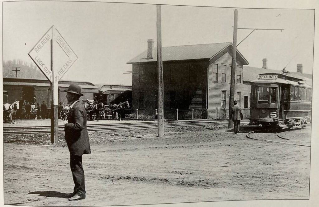
The Erie had two different passenger stations in Olean over the years. The first was built in the 1850s when the line through Olean was constructed and lasted until around 1902.

The second station, shown above and in most of the photos that follow, was used by the Erie and later the Erie Lackawanna Railroads and was destroyed in 1988 by Conrail.
Station Photographs


Passenger Trains
The scan below shows the passenger trains departing from Olean in 1900.

Other Erie Photographs


Pennsylvania Railroad
The Pennsylvania Railroad (PRR) was the dominant railroad in Olean and was the junction of three different lines. The main PRR route through town was the north-south line between Buffalo and Pennsylvania. North of Olean the PRR split and one line continued to Buffalo while the other followed the old Genesee Valley Canal to Rochester.
The PRR line shown in the map above coming in from the southwest corner was the former Olean, Bradford and Warren Railroad line going to Bradford.
The PRR line coming in from the west and paralleling the Erie was the line that went Salamanca and then followed the Allegheny River south into Pennsylvania.
The PRR had a large station downtown near the corner of Sullivan and Union streets as shown in the 1891 map below. The postcards below the map show what the PRR station in Olean looked like.
According to railroad historian Larry Kilmer, at one time the Pennsylvania Railroad station hosted three railroads, the Buffalo New York and Philadelphia Railroad, The Olean Bradford and Warren Railroad and the Lackawanna and Pittsburg Railroad.

PRR Station Photographs


Other PRR Photographs


Pittsburg, Shawmut and Northern
Olean was the western terminal for the Pittsburg, Shawmut and Northern Railroad. This line began in 1881 as the narrow-gauge Olean Railroad that extended east through Ceres to Bolivar. The line went through a series of ownership changes, eventually becoming the Pittsburg, Shawmut and Northern.
I believe that the PSN and predecessor railroads initially used the PRR station in Olean. A 1915 map (below) shows a PSN station just north of Green Street between Union and Barry Streets. Based on the Sanborn maps, the line to this area appears to have been laid between 1894 and 1898 and the station built between 1904 and 1909.

Passenger Trains

Photographs


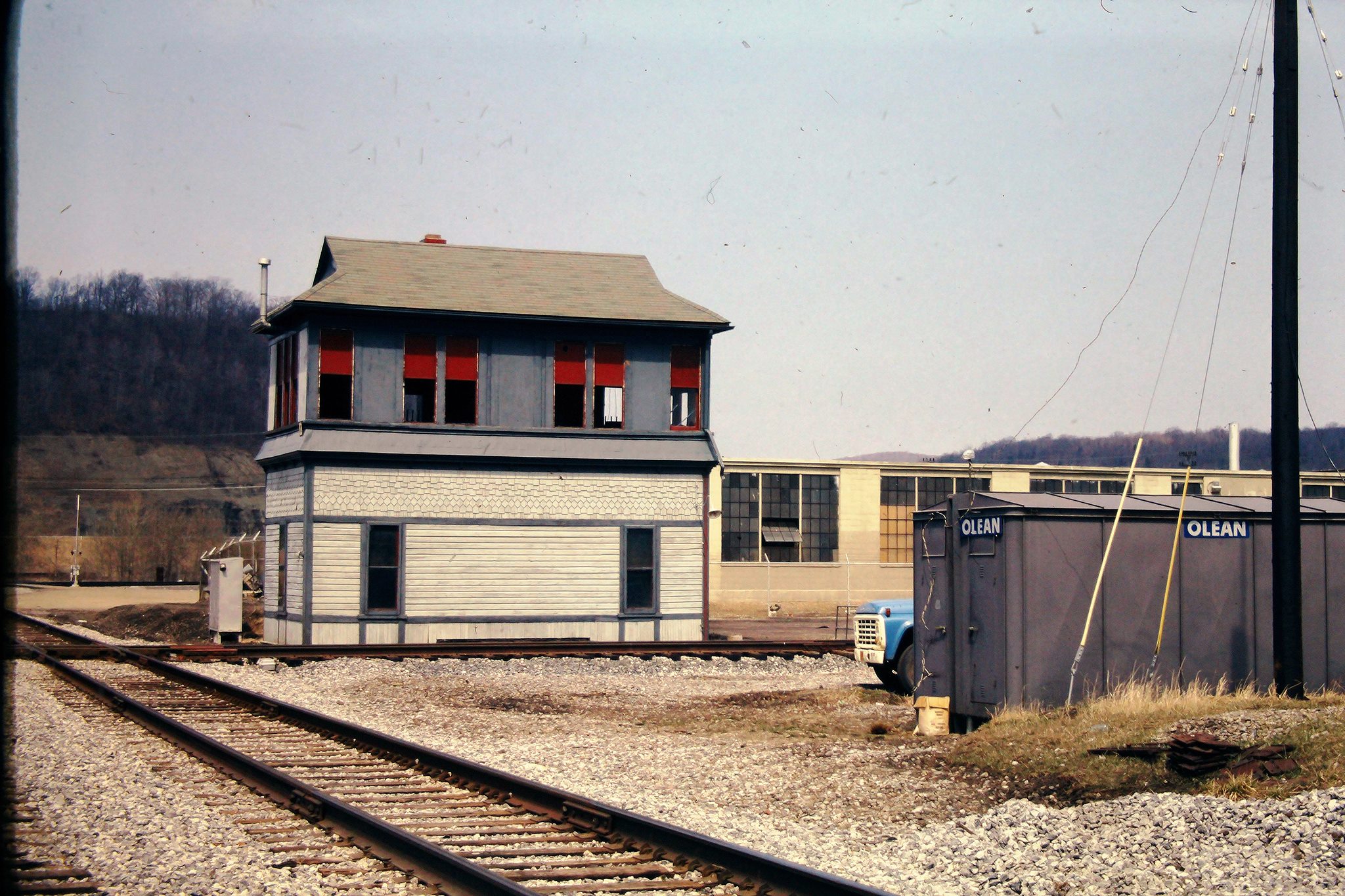
X Tower
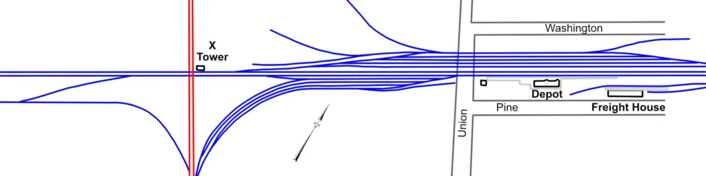
X Tower controlled the crossing of the Erie Railroad and the Pennsylvania Railroad in North Olean. It was located on the north side of the Erie Railroad tracks and the east side of the PRR tracks.
An earlier version of X Tower was located just to the west of the depot north of Pine Street and east of Union Street. I don’t know when the new X Tower was constructed but the 1909 photograph of the station above showed both towers, and a 1918 Erie Railroad valuation map marked the older tower as a “disused.”
Photographs


Learn More
- Robert D. Jacobi and William R. Jacobi. Trackside around Olean, New York 1960s-1970s with Robert D. Jacobi and William R. Jacobi.
- OLEAN… MEMORIES BACK IN TIME….. Facebook group.
- Pittsburg, Shawmut & Northern Railroad Historical Society